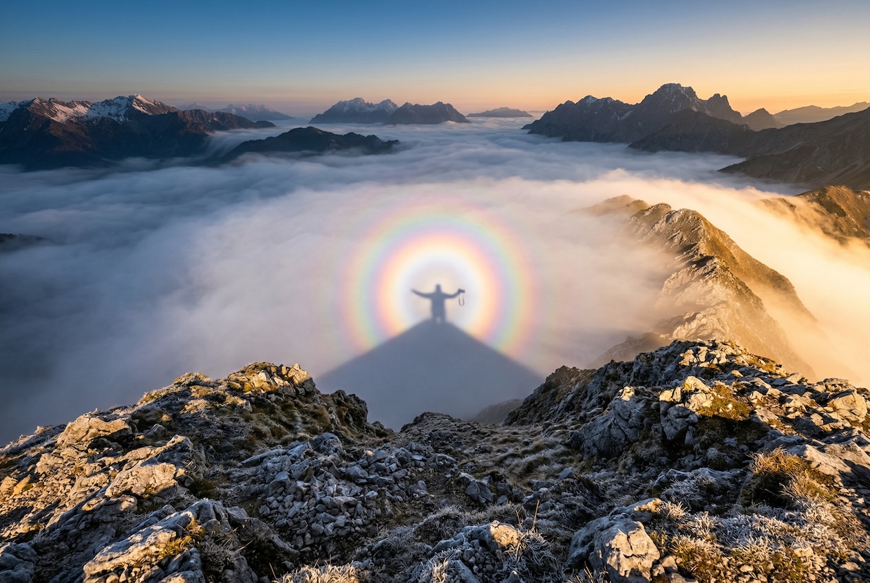
A Brocken spectre occurs when a photographer stands on an elevated ridge or summit with the sun low behind them and a layer of fog or cloud below. Their shadow is projected onto the cloud surface, appearing enormously magnified and surrounded by colorful concentric rings known as a 'glory' - created by light diffracting around tiny water droplets. Named after the Brocken peak in Germany's Harz Mountains, where the phenomenon is famously frequent due to persistent low cloud and exposed ridgelines.
Inverza checks several things simultaneously. First, whether the observer's SRTM elevation is above the nearest METAR-reported cloud base (BKN/OVC layer), and whether the sun is in the optimal 2-20 degree altitude band at sunrise or sunset. When METAR data isn't available, the detector falls back to forecast-based indicators - high low-cloud cover, high humidity, and low visibility - combined with significant observer elevation. The upper sky (mid + high clouds) must be clear so the sun shines unobstructed onto the photographer's back.
The detector also checks whether you're actually standing on open terrain. A forested mid-altitude summit may have all the right atmospherics, but the surrounding trees block low sun and break up the projected shadow - the spectre simply doesn't form. Inverza queries OpenStreetMap landcover at the exact spot: tags like natural=bare_rock, scree, cliff, fell, or glacier earn full confidence; tags like natural=wood or landuse=forest drop the score below the surfacing threshold so a forested location never produces a false-positive Brocken alert. Where OSM has no relevant polygon (or the lookup fails), the app falls back to a latitude-aware tree-line estimate (~2,250 m in the Alps, ~1,300 m in the Scottish Highlands, ~1,200 m in Norwegian fjords, sea level above 70°N) and compares it against your SRTM elevation. Open above the line: full credit. Forested well below: heavily penalised. The detector's reason string surfaces both signals so you can see exactly why a spot scored what it did.